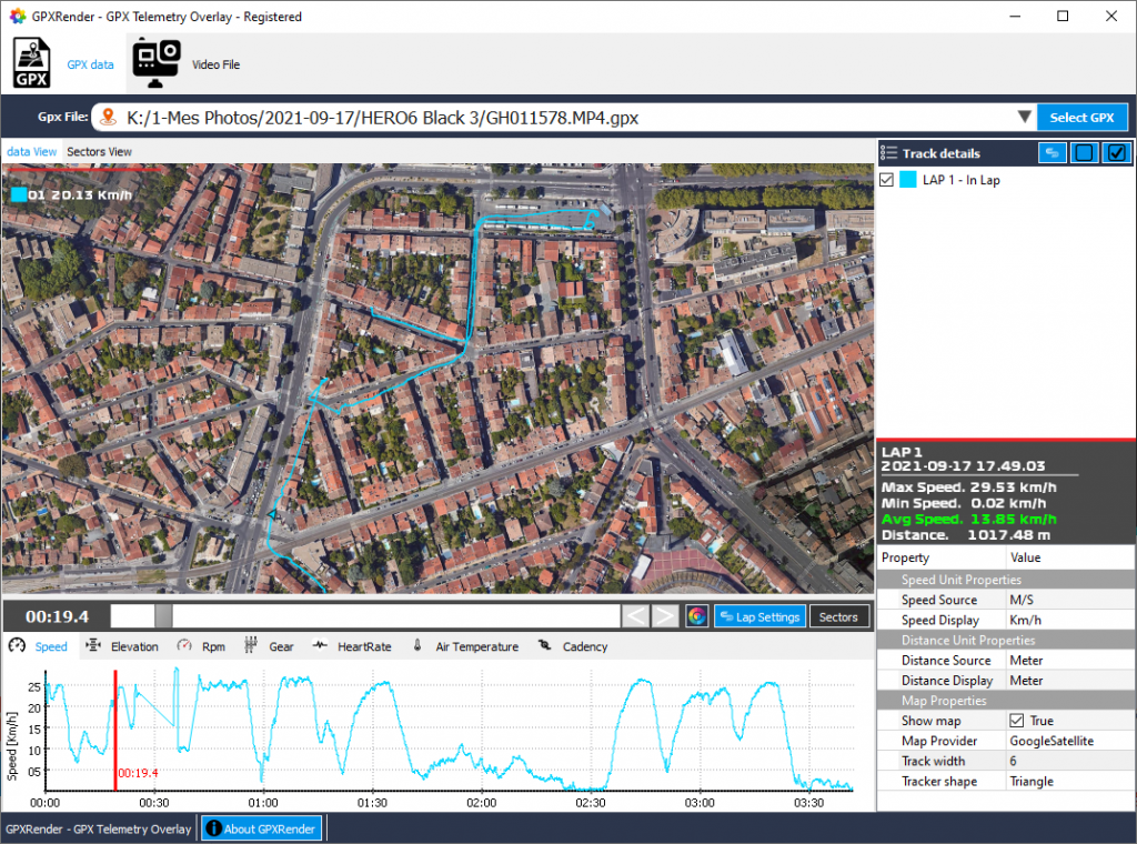
In this tutorial, we are going to see how simple is it to add your GPS route path in your videos. We will be able to Visualize the route you have taken; See your location as you move along the path. See your trajectories on a projected map and finally include it in your video:
MacOSX users: You can download GPXRender here If you don’t have it yet installed on your computer. Unzip the file, you will find a file called “GPXRender.app”. Right click on it and click on “Open” in the menu. Confirm that you want to open it.
Launch GPXRender then select your video file (can be a GoPRO video file) containing GPS metadata (your can also open a GPX file to add GPS information on any video). On the “Video file” tab, you will be able to add a MAP widget or load a theme already containing the MAP widget.
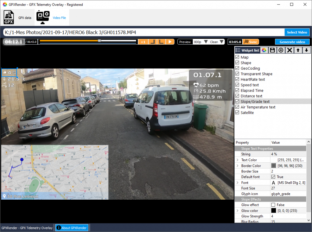
When you select the MAP widget on the video preview, you will be able to customize settings like the MAP provider (Google map, OpenStreeMap, satellite view or street view). All you will have to do after that is to click on the “Generate video” button in order to overlay the GPS MAP on your videos.
Easy and fast.
How do i join more than 1 gopro video file.
How do i join more than one gopro video file.
The way I have done it is the following:
Open GoPro video 1, go the GPS data view and save the GPX file.
Open GoPro video 2, save the GPX data.
If there is a third/forth… repeat as necessary.
Open the the gpx files in a editor, and combine them. If you know XML it’s easy, if not, you want to copy the data points from each file inside the start/end tags. The last line of the file looks like this “” so make sure you copy the “” lines in order, leaving out the first and last lines of the file except the first and last line from the first file.
Then use something like Shutter Encoder to merge all the videos together. Make sure to go into the settings (top left gear icon) and enable “Process file list as Merge”.
This makes one big video file that matches up with all the data in the merged GPX file.
Open GPXrender, open the video, then the data file. Set the start/finish as needed.
The comment system stripped the XML tags, so it’s just showing “” instead of the data. The data between the first empty quotes is: (/trkseg)(/trk)(/gpx), the next empty quotes are: (trkpt). Replace the normal brackets with pointy ones, shift+, and shift+.
The way I have done it is the following:
Open GoPro video 1, go the GPS data view and save the GPX file.
Open GoPro video 2, save the GPX data.
If there is a third/forth… repeat as necessary.
Open the the gpx files in a editor, and combine them. If you know XML it’s easy, if not, you want to copy the data points from each file inside the start/end tags. The last line of the file looks like this “(/trkseg)(/trk)(/gpx)” so make sure you copy the “(trkpt)” lines in order, leaving out the first and last lines of the file except the first and last line from the first file.
Then use something like Shutter Encoder to merge all the videos together. Make sure to go into the settings (top left gear icon) and enable “Process file list as Merge”.
This makes one big video file that matches up with all the data in the merged GPX file.
Open GPXrender, open the video, then the data file. Set the start/finish as needed.
* The comment system won’t let me use pointy brackets, Replace the normal brackets with shift+, and shift+.
Can we find other widget somewhere ?